Abbazia di Lorsch, Sito Patrimonio Mondiale Unesco
Crediti
Cliente
Amministrazione Statale dei Palazzi e dei Giardini della città di Lorsh
Collaboratori
Autori
Lorenz Dexler
Topotek 1
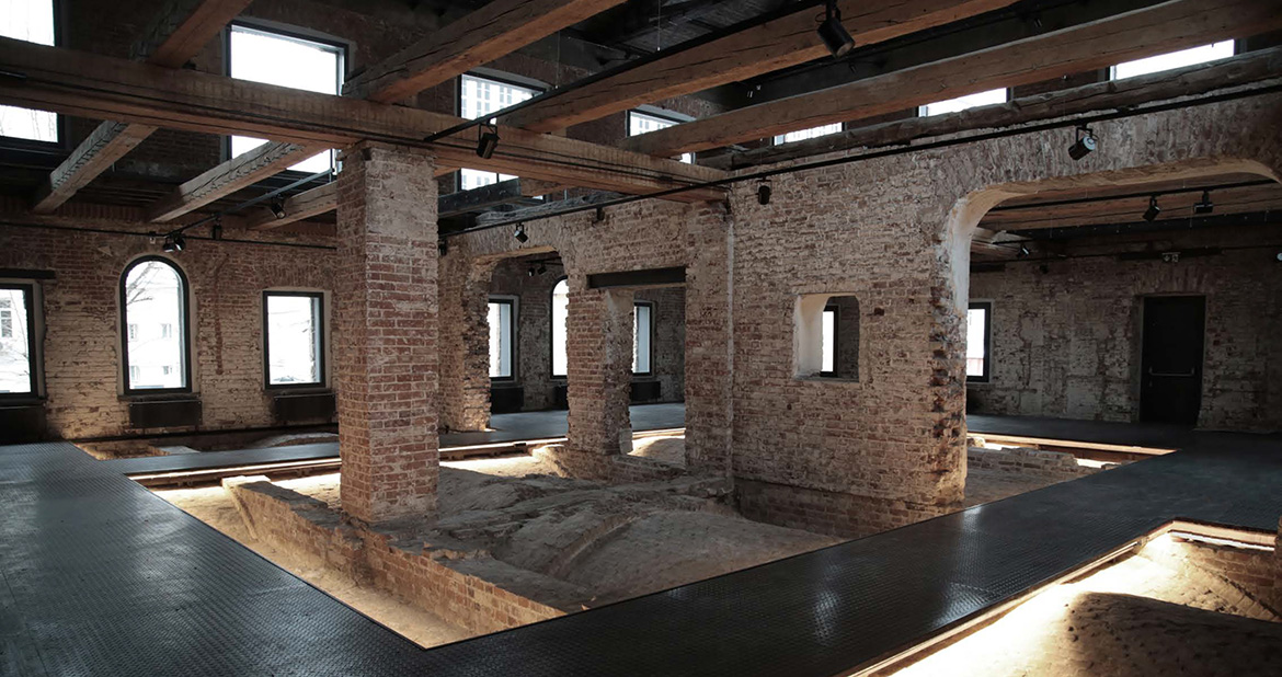
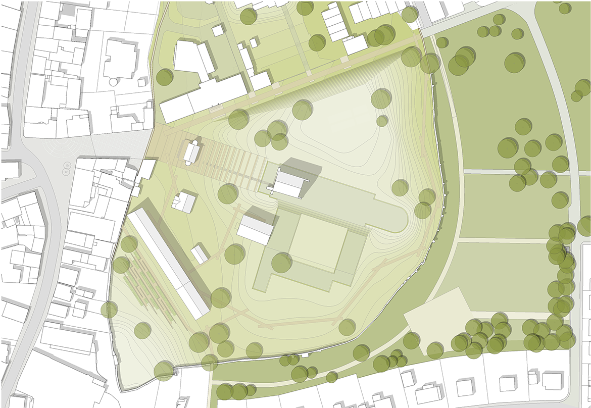
New architectural, landscape and didactic interventions have been developed with sensitivity to the UNESCO World Heritage Site, Kloster Lorsch. This contemporary layer of design helps to establish the historical importance of the site as a clear and vibrant component of the visitor’s experience.
Disegni tecnici:
Report esteso:
Relazione estesa
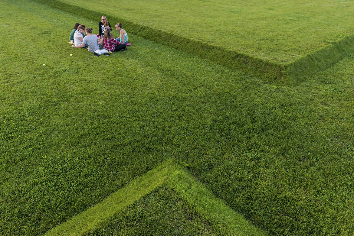
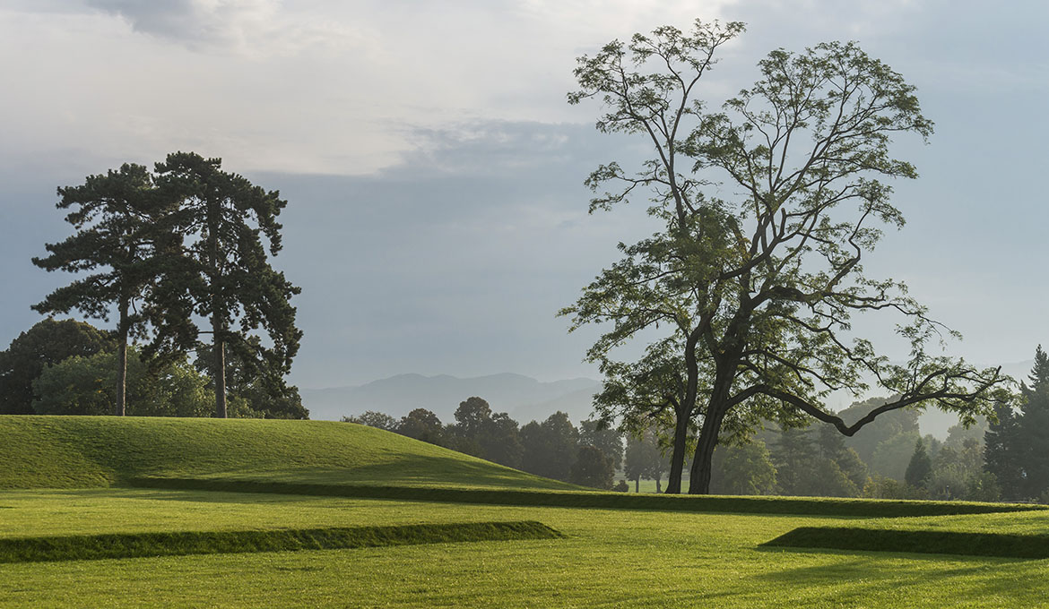
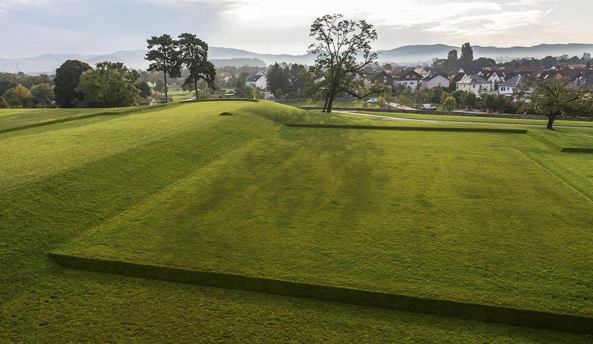
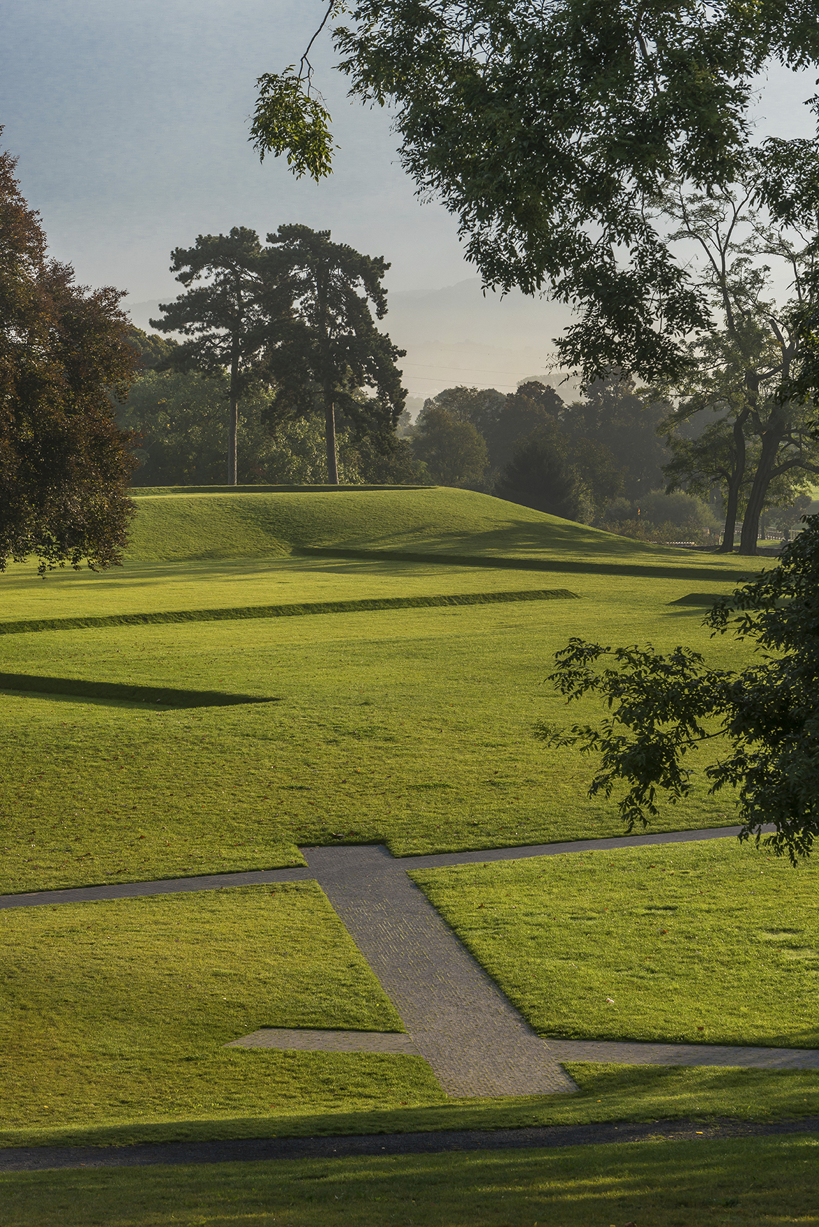
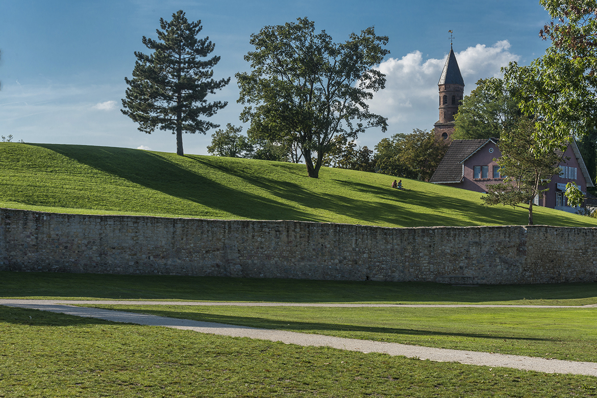
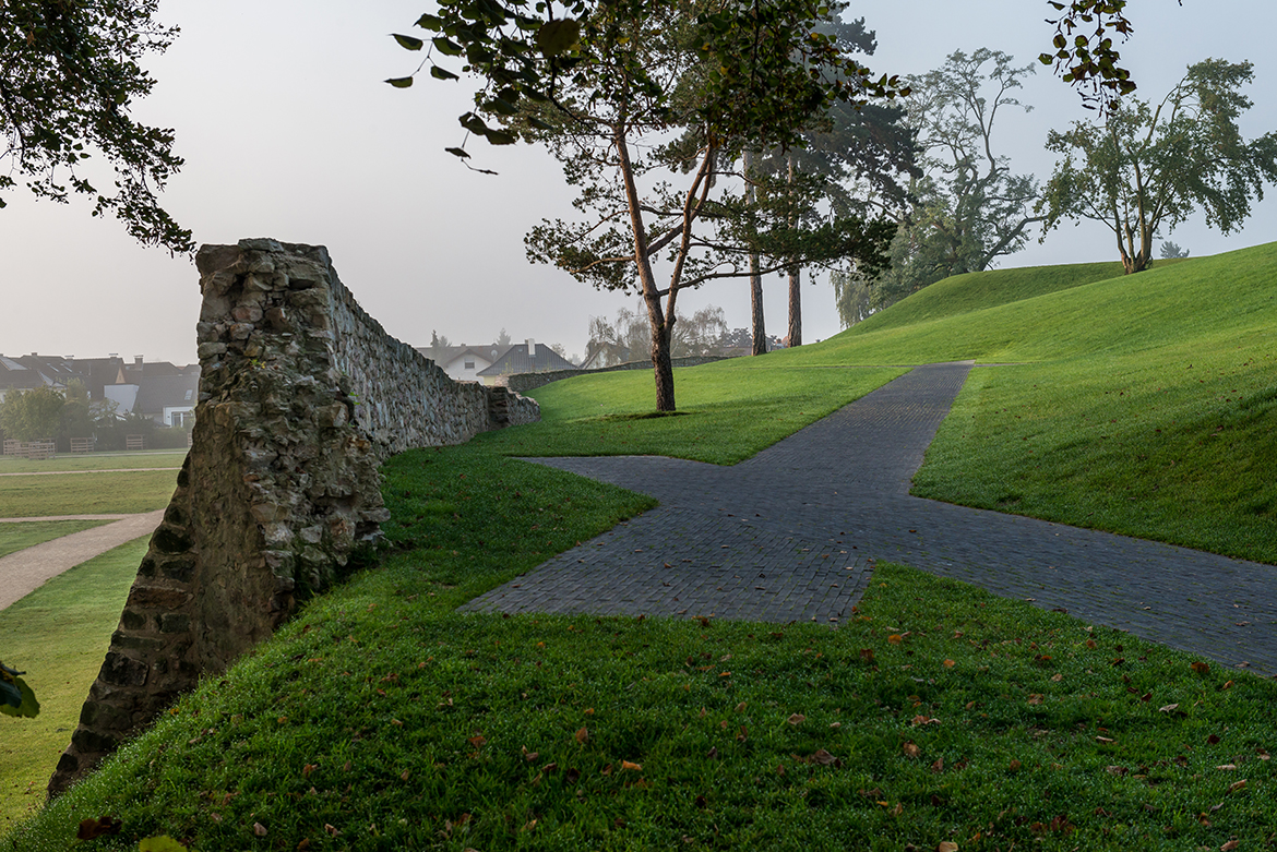
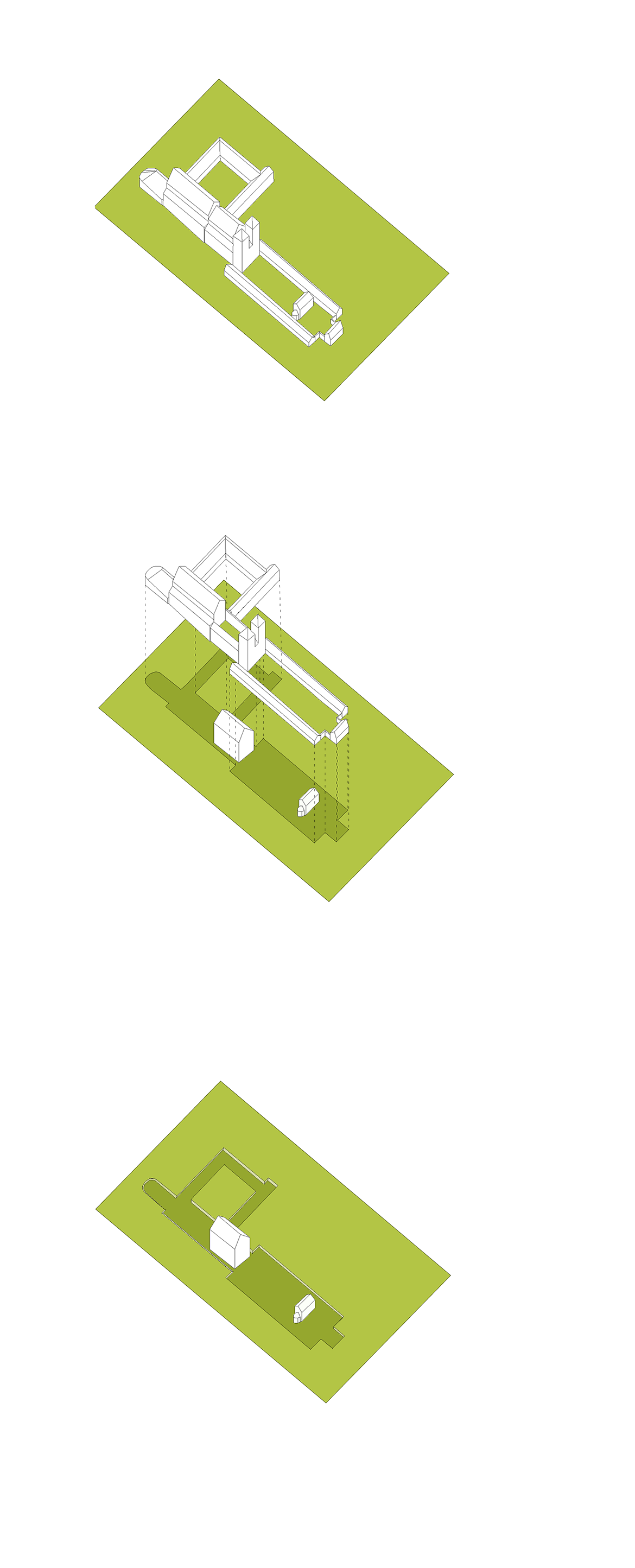
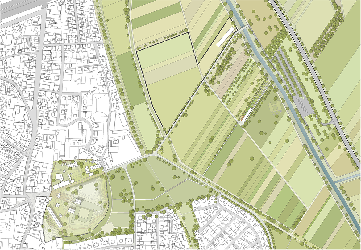
New architectural, landscape and didactic interventions have been developed with sensitivity to the UNESCO World Heritage Site, Kloster Lorsch. This contemporary layer of design helps to establish the historical importance of the site as a clear and vibrant component of the visitor’s experience. The central concept of the landscape architectural design is to visualize the nearly completely lost monastery compound. After the demolition of the monastery, the grading of the site was altered and flattened, especially to the south. This work included the removal of a sand dune, which once informed the original character of the area, along with a sparse flora. The monastery was established on this site for its special scenery, which the proposed landscape plan intends to recover. A ‘restoration’ of the monastery compound is done with two measures. The lost sand dune will be recreated as a gentle, grassy hill, along the lines of the original, as far as this is possible. The second key measure of the landscape plan is the visualization of the central axis of the monastery, as a footprint in the lawn for the monastery district. The trace of the lost monastery compound is reinforced by incising the plan into the ground plane by 45 cm compared to the surrounding terrain, referenced to the historical height of the axis to the Benedictine Plaza. This is achieved by reclaiming the border areas of footprints in the course of modelling the topography. There will be no excavation, as essential facet of the plan, as the strata of history will remain intact.
Cronologia:
2010
Inizio lavori
2014
Fine lavori